


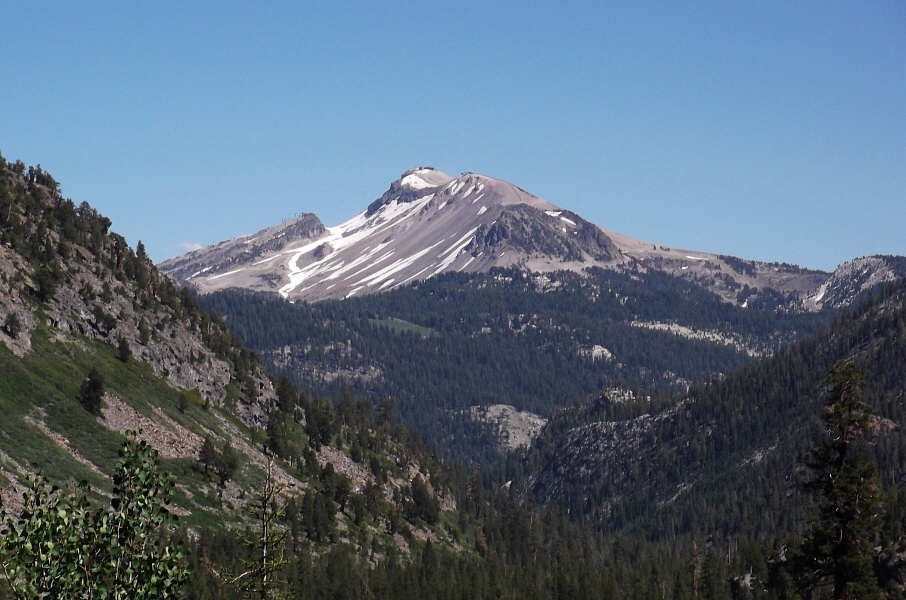
Mount Ritter - Southeast Glacier, July 2010
 as seen from HWY 395 just outside the town of Mammoth Lakes. Banner Peak at right with The Minarets peeking at far left.")
My early exposure to the mountain subrange that makes up Mount Ritter, Banner Peak and the Minarets was through ski/snowboard magazines and videos filmed at the nearby Mammoth Mountain ski area. Sure, the cork 540 over the 60-footer was sick and all, but I always found the intriguing crest of peaks dominating the background to be incredibly distracting. Many copies of Transworld Snowboarding later and as many years would go by before I actually pieced together where exactly on the continent the fascinating Ritter Range, as the subrange is called, lies. More time passed before my casual curiosity evolved into something a bit more, say, academic at which point I finally discovered two names - Banner and Ritter. Being the taller of the two, Ritter was eventually added to my "list" of things to climb should I ever find myself venturing into the High Sierra. High Sierra Author, R.J. Secor's assertion that Ritter may be the most prominent peak in the Sierras certainly helped reinforce my desire to scale the peak's uncharacteristically loose (for the Sierra) rock. I was also surprised to learn that for a hundred years or so Mount Ritter appeared behind Half Dome on the Sierra Club emblem. I can't seem to find any evidence of Ritter on the current version of the logo though, so don't go calling me out on this detail please. Nevertheless, of all the iconic peaks in the range this one seemed like it wasn't to be missed!
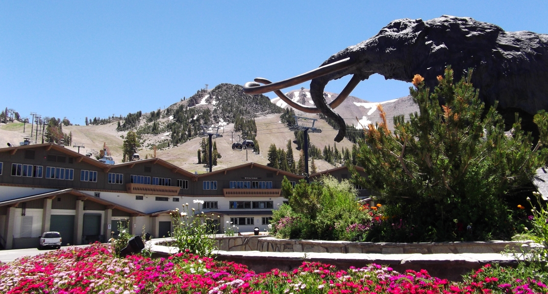
It was not until the scenic drive south from Lee Vining, detouring briefly through June Lake (another ski area from my TWSnowboarding past) en route to Mammoth Lakes, that it dawned on me how volcanic this region is. In a vast mountain range famous for its abundance of high quality golden granite, I suddenly found myself in a volcanic oasis of pumice, basalt and lava that would not be out of place back in my PNW home turf. Mono Lake, the neat line of volcanic domes and vents that stretch south to Mammoth Lakes and culminating with the Ritter Range itself - all are the result of volcanic forces at play. Even the 11,053-foot "hill" that is the ski area could be considered an active volcano of sorts. This hill apparently still emits hazardous gases that kill trees as well as the occasional ski patroller. There's also the Devils Postpile National Monument nearby with its stunning display of columnar basalt to further remind us of the molten rock that boils not far beneath the surface. And if that wasn't enough, let's not forget the irrefutable evidence of a fault line that lies just on the outskirts of town. It's now a bit of a tourist attraction, but suffice to say if word of deadly odorless gasses don't make your ears perk up then a repeat of the earth shaking that caused this random fissure to spontaneously appear certainly might.
Anyway, I had a shuttle to catch and wasn't going to settle for coach. Yes, the ski area manages a shuttle service that takes visitors from the base area to Devils Postpile National Monument and all stops in between. For $7 I arranged to be dropped-off at the hairpin turn near Agnew Meadows Campground and be picked-up at the same location the following afternoon. Unless planning on entering the national monument grounds outside the 7:00am - 7:30pm window, or have a camp spot reserved at one of the numerous campgrounds between the resort and the road-end at Red's Meadow, the shuttle is unfortunately one's only option. Don't bother trying sneaking in as a booth manned by park rangers guards entry into the monument. Fortunately, on busy days the interval between shuttles (there may be 4 running at all times) is less than the advertised 20-30 minutes. Unfortunately, all shuttles returning from Red's Meadow will be butts-to-loins full by the time it reaches the waiting area at the hairpin and that much-deserved beer will have to wait a few more cycles. Having gotten a lazy mid-morning start from the Tuolumne Meadows campground earlier that same day, it wasn't until around 2pm that I finally started hiking the River Trail from Agnew Meadow. Rangers at the Mammoth Lakes ranger station informed me that the approach to the preferred base camp at Lake Ediza was only about six miles in length, so I had plenty of daylight to work with regardless. They helped me with maps, beta, permits (I even got permits for the following Mount Sill climb here) and of course the by now much despised bear canister (once again rented for $5/day).
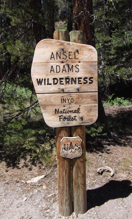
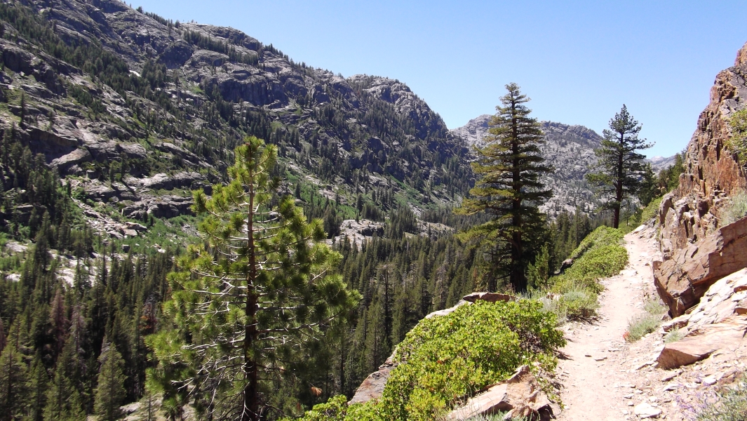
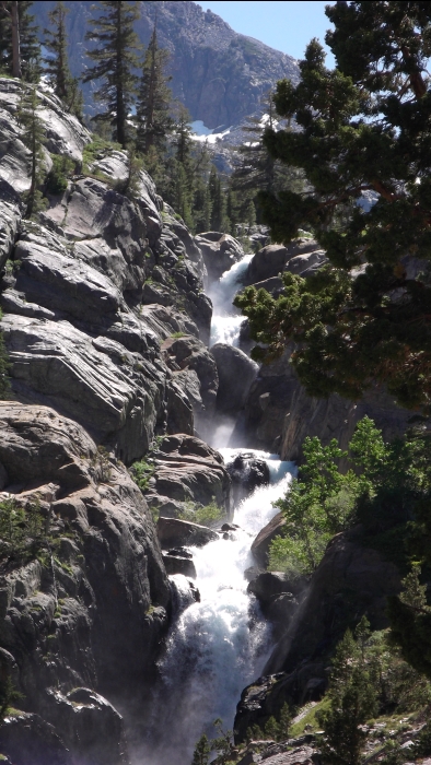
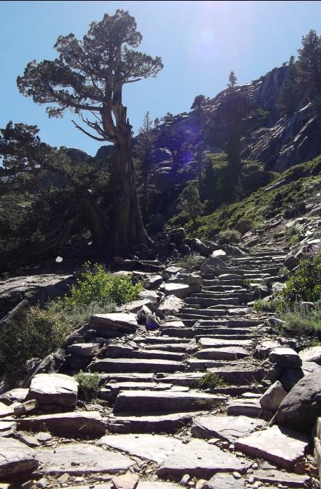
Beyond Agnew Meadow, the trail makes a high traverse above the Middle Fork San Joaquin River before slowly descending to the forest below. Crossing the river shortly after a fork in the trail, I continued up the opposite side of the valley towards Shadow Lake. Here's a view back at the Mammoth Mountain ski area from this part of the hike. Federal dollars from the American Recovery and Reinvestment Act of 2009 must be flowing freely here in the Ansel Adams Wilderness, as I encountered numerous trail crews working diligently to improve this portion of the trail. Not that the trail really needs improvement mind you. Literally paved in stone, this veritable appian way, complete with granite steps and a sidewalk that appears to have been dynamited into the cliff above a waterfall really is a beauty of a trail! Officials at our local North Cascades National Park would do well to observe and embrace the radical notion that popular trails such those leading up into Boston Basin and Eldorado Creek, for example should also be properly maintained.
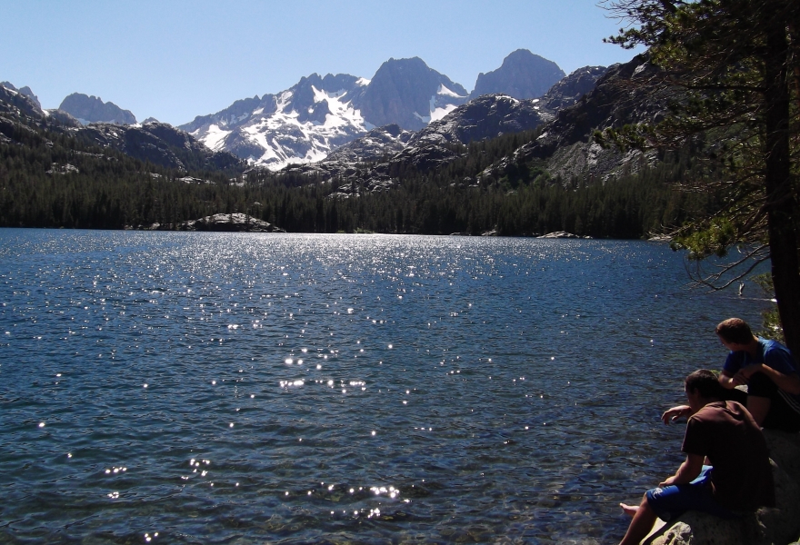
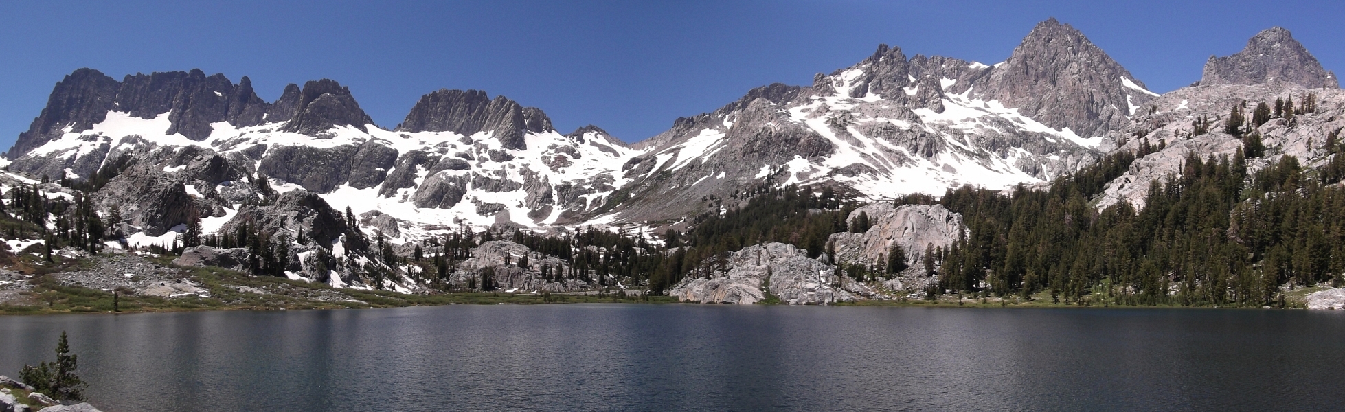
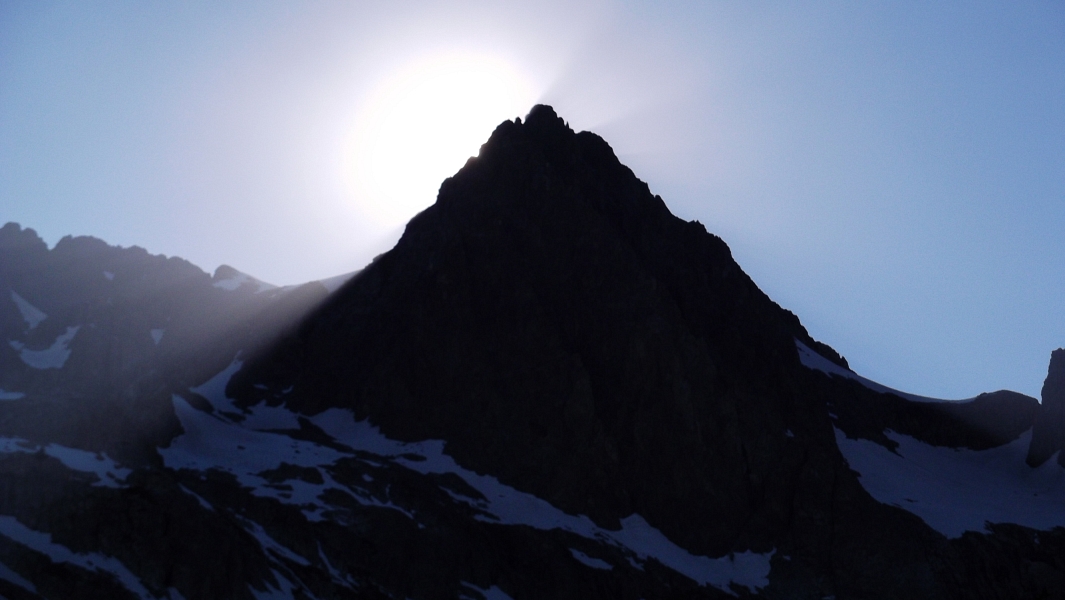
Save for intermittent glimpses from the shuttle, the first up-close view of Mount Ritter is had at Shadow Lake. The lake and perspective on the peaks beyond reminded me a bit of the view across Pete Lake in Washington's Alpine Lakes Wilderness with the Lemah's in background and such. Camping isn't permitted anywhere around Shadow Lake by the way, but it isn't a long hike to reach the first camp spots just beyond. Continue a bit farther up the trail to Lake Ediza however, and you'll be treated to a view of the Ritter Range that is nothing short of breathtaking! Spread out before you in a grand panorama of towering spires, serrated ridges and vertiginous faces, this has got to be one of the finer spots in the Sierra. Rather than continue to a camp on Ediza'a northwest side as advised by the rangers at Mammoth Lakes, I instead chose to explore my options along the south shore. There's no point in enduring a creek ford at the lake's outlet when one can simply follow a trail around the other side instead. I soon located a flat, slabby outcropping suitable for my small tent near the southwest shore and called the spot home for the night. Looking around, I noticed three if not four other well dispersed parties camped near the lake and wondered if I would be having some company with me the following day. The beef stroganoff was delicious as always, but the sun setting behind Ritter that evening left a longer-lasting impression and got me psyched for the climb.
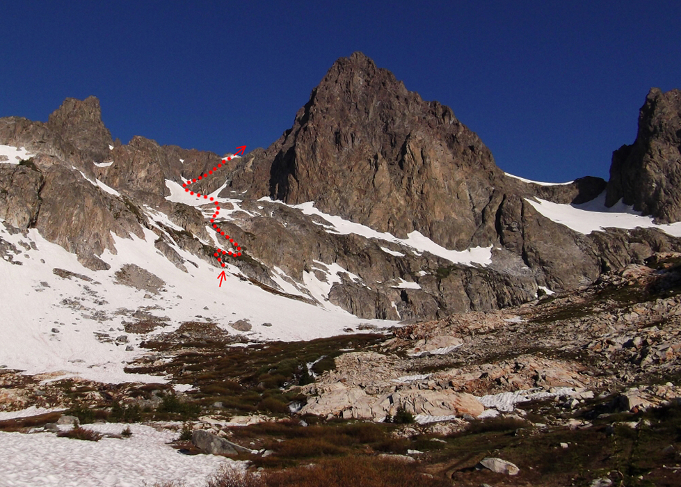
I awoke with the rising sun, and foregoing breakfast or coffee began making my way towards Ritter's SE Glacier route around 7am. Having previously deferred the creek ford, I now had no option but to remove my boots and walk through the relatively shallow and slow moving water of Ediza's inlet streams. Once across, I followed various bits of path angling up and right through trees to reach open heather low in the basin below Ritter's East Face. Continuing up, I soon found myself on snow and proceeded on an uphill traverse aiming for a spur of heather and rock that breaks the cliffs above. A short bout of moderately exposed third class scrambling saw me to a heathery bench just left of a steep snow finger. From my perspective, it looked like the finger would provide the most direct line to easier terrain above. I strapped on my crampons and began working my way up. Although not difficult, a slip could have serious consequences thanks to the sketchy run out. Rather than take the finger all the way to the top, I exited right onto rock and finished-up on steep, soggy grass next to a watercourse. The final moves involved some wet, mossy rock through the small waterfall feeding the aforementioned watercourse.
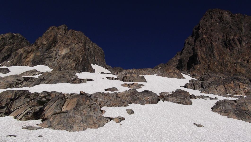
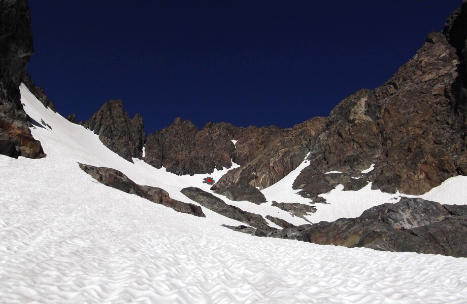
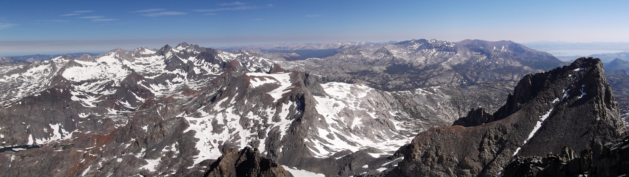
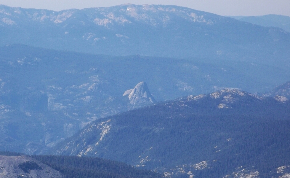
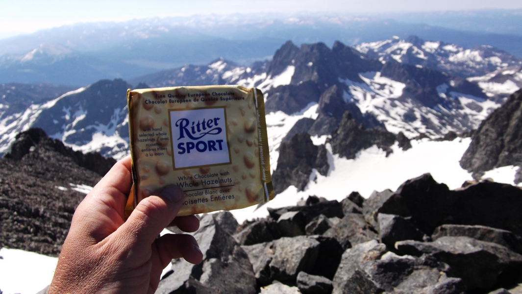
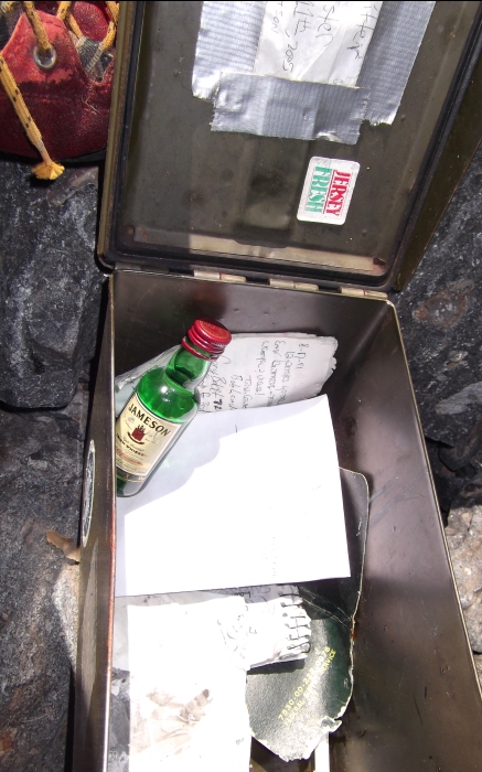
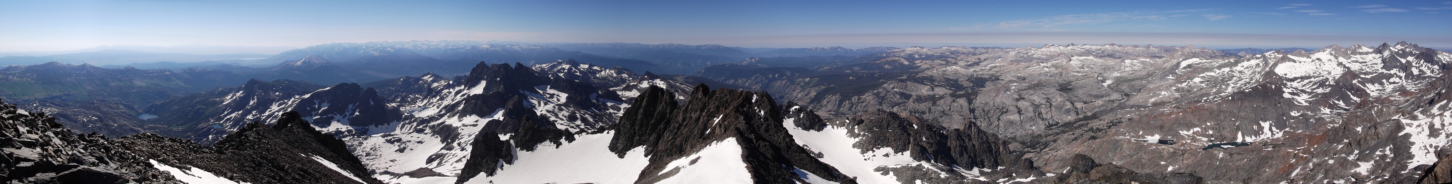
Someone else had built a cairn right where I topped out, so I'm pretty sure I was mostly on route to this point. Also, looking down I discovered that the snow finger could be avoided entirely by continuing down past the grassy area and contouring around and below the snow on a heather bench (I returned this way). Up ahead, it looked like nothing more than a long slog to reach the upper part of the SE Glacier. And what a tedious slog it was! Resembling small craters left behind by mortar fire, Californian sun cups are truly in a class of their own. Near the head of the bowl cradling the glacier (note red dot), I turned right and exited onto a large talus slope. Walking up the talus, I soon reached the final snow slopes beneath Ritter's summit. The snow was firm and steep enough on the upper half that I felt crampons were once again warranted. Moments later I was scampering along the summit ridge and taking in the expansive panorama from the top of The Ritter Range. Like Mount Lyell easily visible to the north, this perch offers an interesting perspective on Yosemite not to mention Half Dome itself. Although impressive in their own right, the Minarets and anything else for miles around for that matter are dwarfed by Mount Ritter. Oh, and the summit register appears to be a 30 caliber ammo box. That's certainly a first for me!
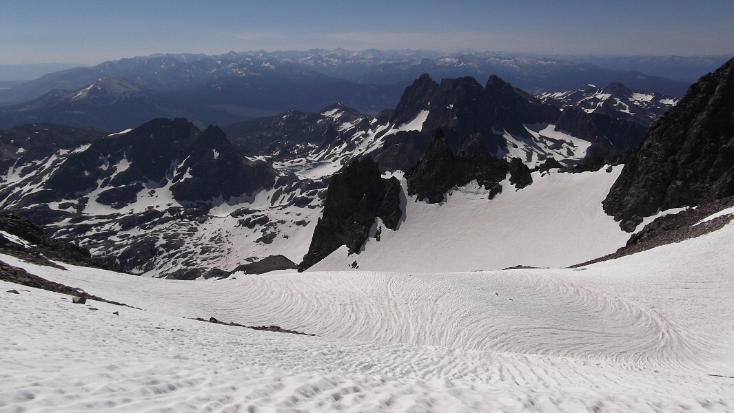
Through the haze I could make out the beginnings of the Owens Valley and the White Mountains running down its east side. After what appears to be a brief lull in the mountains immediately to the south, the High Sierra abruptly rear back up again. This region contains California's tallest peaks in what probably constitutes both the wildest and widest east-west span of mountains in the range. This is where I would be heading next. What seemed like an endless grunt from camp to summit only took me about two-and-a-half hours. Being ahead of schedule, I allowed myself a nice long rest up on top. As before, I hadn't seen evidence of any other parties since leaving that morning and wouldn't again until reaching camp. The hike out was uneventful though the trail crews did not seem to have made much progress since the day before. I honestly can't blame them though considering the annoying mosquitoes and oppressive heat. Waiting for the shuttle back at Agnew Meadow took a bit longer than expected courtesy of the throngs of tourists returning from Devils Postpile. But truth be told, I was in no hurry and Mammoth Mountain really does do a good job in managing their shuttle service-they eventually sent a shuttle just for the folks waiting at the hairpin turn.
With the slopes sparsely covered in dirty patches of old snow, the ski area had reinvented itself as a mountain bike trail and terrain park for the summer. I briefly considered renting a DH bike for a couple hours later that afternoon, but I had beer and food on the brain and a campsite to poach before it got dark. Tired after two fine days in the beautiful Ansel Adams Wilderness, I fell right asleep that evening and spared no thought to earthquakes, volcanic eruptions or hazardous gasses for that matter (not even my own). Sweet dreams!
Click here to view photos.
![]()


