Select from list below to jump to a specific area on this site.
| Latest Posts |
Monday, November 25, 2019
Cassiope & Saxifrage - W & SE Ridge, July 2019
Located at the southern end of the Birkenhead-Cayoosh Divide, Cassiope Peak and Saxifrage Mountain are a couple attractive peaks endowed with excellent scramble routes. This is an area with a high concentration of popular climbs including Cirque Peak, Cayoosh Mountain and Mount Marriott just to name a few. Clearly visible from Highway 99 just downstream of the Joffre Lakes parking area, Cassiope and Saxifrage both make for an enjoyable day trip starting from the Birkenhead River Valley and Spetch Creek FSR. The approach takes one through a delightful moss carpeted forest followed by several less than delightful boggy and mosquito infested meadows, then along the shore of lovely Valentine Lake to eventually reach a large col between the two peaks.
Notices posted on trees along the trail and at the lake urge visitors to be on the lookout for anything that may offer up clues as to the whereabouts of a couple that presumably went missing somewhere in the area back in 2010. Despite extensive SAR efforts to solve the mystery of their disappearance in the years since, including prominent local mountain guides and the like, nothing has ever turned up. No tent, no packs, no clothing...nothing other than their vehicle parked at the trailhead. More info on this here.
After a short rest to wring out our socks and swat mosquitos at the lake, Agata and I made our way up through talus and the occasional snow patch to the aforementioned col. I made a quick dash for Cassiope while Agata stayed behind to massage her aching feet. The route up Cassiope is obvious, going right initially up a heather and rock ramp to gain the ridge. Easy scrambling then leads to a false summit with an unusual down-sloping slab feature on the opposite side. Unsure of how well my boots would grip the rock, I skirted the slab by following ledges at right. The summit is a short scramble up from the base of the slab. I had no trouble smearing and hand-over-handing along the edge on my return. Soft snow on the east side of the ridge enabled me to shortcut the return by plunge stepping and glissading back to the col. As for Saxifrage, the gist is to follow the broad talus crest to the point where it steepens, and the climbing becomes more difficult. Traversing ledges, ramps and gullies to the left until able to easily climb up again overcomes these difficulties. Repeat as necessary till you run out of mountain. An abundance of cairns helps guide the way. Views from up top are fantastic and offer a unique perspective on the Cayoosh Valley and Joffre Group in particular.
More trench foot action on the descent back to the truck, but by that point we couldn't be bothered to try and tiptoe around all the waterlogged and muddy sections of trail. We clocked-in at about 11.5 hours round-trip, which given our mid-morning(ish) start meant that we made full use of the long July daylight hours. Spicy Baken-Ets (why-oh-why aren't these available in BC?) and chilled beer on the bouncy ride back down to the paved road rounded out another excellent day in the South Coast Mountains!
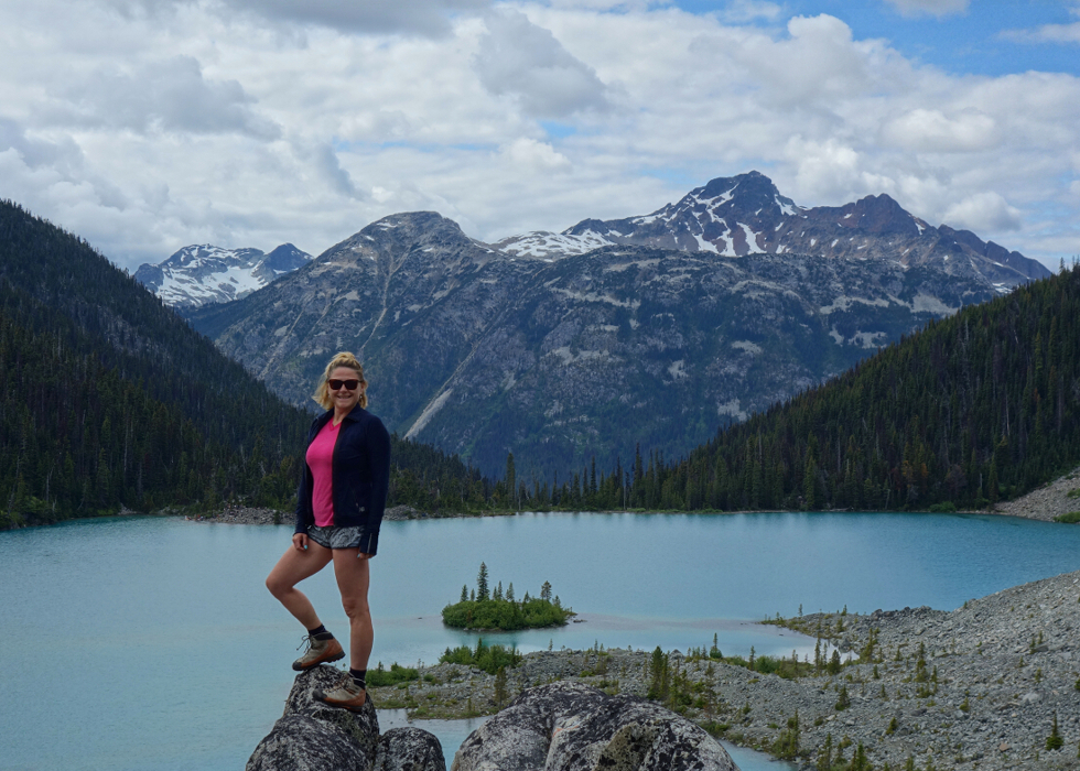
Overflowing parking lots, overcrowding on the trail, litter and toilet paper scattered about along the 3-mile hike to the upper of the three Joffre Lakes, all this and more have become par for the course in the uber-popular Provincial Park that goes by the same name. Up until recently I've only witnessed this mayhem from a distance, driving by an endless string of cars parked illegally in the vicinity of the trailhead. Nowhere else can one enjoy "wilderness experiences" such as queueing up for photos standing on the infamous Instagram Log or lines 30-40 people long simply to use the trailhead pit toilets. Who can hold it that long anyway!
Don't get me wrong, the park is undeniably idyllic and a must-see when visiting the area - a point not lost on the tour promoters and throngs of tourists that flock to this overrun gem of the South Coast Mountains. What's not to love, with views of towering peaks, dramatic hanging glaciers and picturesque turquoise lakes seemingly tailor made for the average pedestrian to enjoy. Having been drawn to these peaks myself, whereupon I climbed both Mount Matier and Joffre Peak, only Slalok Mountain remained for me to complete the Joffre Group triumvirate. Whereas the previous two were approached via the far less popular and sadly now defunct Cerise Creek Trail (a significant landslide in Spring 2019 took out a good portion of the trail), Slalok Mountain is normally approached via, you guessed it, the Joffre Lakes Trail. Alas, the time had finally come to partake of the Joffre Lakes gong show!
Slalok's West Ridge scramble route is an aesthetic line that's preceded by a pleasantly solitary approach once beyond the upper lake, and entails a bonus summit going up and over smaller Tszil Mountain via Taylor-Tszil Col. There's fun scrambling up through a smaller cliff band shortly after the Tszil-Slalok Col then over some easier terrain to reach a steep rock face barring access to Slalok's summit ridge. The SSWBC guide is uncharacteristically vague in describing where to go next from here. Straight up the middle of the face where ledges give way to blocky but steep, down sloping, lichen encrusted rock seemed the most obvious. The dusting of fresh snow visible on the high peaks in the days prior had thankfully melted off, but the lichen was still a bit slick where it mattered the most - the crux. Truth be told, I was more concerned with reversing the moves than I was with pushing the line up. Not to be rebuffed, I tried traversing ledges going right, but with 1000+ feet of mostly vertical rock on the peak's south side this was obviously a no-go. Tackling the ridge head-on seemed to entail a good 15 feet of 5.Hard climbing right off the deck. Also, a no-go. I tried far left, up a steep, exposed dihedral of sorts and got to within a few feet of the ridge crest before a large block I was climbing on threatened to free itself from the mountain and take me down with it to the Tszil Glacier far below. I carefully backed down and called it. A rope, if for no other purpose than to rappel this pitch would have been welcome. To each their own.
I regrouped with Agata who was waiting patiently for me on Tszil and rested for a bit before starting the descent. We encountered the only other party we would see that day at the Taylor-Tszil Col and wonder if they made it up Slalok as they had intended. Only two other souls just off the beaten track and yet the lake shore is a zoo of people. Funny creatures we humans are. Then finally back down the trail with the rest of the herd we go and promptly to the Pemberton Brewing Company for an unremarkable pint of beer before the long drive back home. And despite all this I haven't quite given up on Slalok yet. Rex's Pillar next Spring anyone?
Flanked by deep valleys on all sides, Birkenhead Peak is very much an island in the sky. Coincidentally, or perhaps appropriately, the peak features a clean prominence over 5500 feet which makes it one of few "ultra prominence" peaks in Southwestern BC. It shares this elite status with a small list of familiar (to me) peaks that include Skihist Mountain, Wedge Mountain, Golden Hinde, Silvertip Mountain, Overseer Mountain and Mount Judge Howay to name a few. Birkenhead is also unique in the fact that the trailhead sits at a relatively lofty ~6500 ft. One of the highest forest roads in these parts, it is unfortunately deeply cross-ditched and requires a good amount of clearance to navigate. For those with the means to drive this road to the microwave towers at its end, the reward is an ascent of just ~1660 feet and a distance less than 1.5 miles (as the crow flies) to reach the summit. And while it does make for a relatively short daytrip, my round-trip time of about 6.5 - 7 hrs suggest that there's more to this outing than what one might expect.
In short, the stats belie not only the indirect route taken to approach the peak, but also the gain/loss over the summit of so-called "Microwave Ridge", return included. Microwave Ridge also happens to be cursed with an abundance of loose talus and choss and makes for slow and unpleasant travel (i.e. forget trying to shortcut it by side hilling across). Lastly, the initial part of the approach entails traversing loose gravel and friable rock across steep debris chutes via a somewhat exposed goat trail. Didn't find this particularly scary per se, but one certainly needs to be on their toes here. Anyway, an approaching weather system robbed me of what I'm sure are excellent summit views and what felt like ~60+ MPH wind gusts on my return added some excitement to what amounted to a surprisingly full(ish) daytrip.
The higher of the two mountains that make up the Whistler-Blackcomb ski resort, Blackcomb Peak requires no further introduction. In terms of climbing, it features a variety of routes ranging from technical rock and scrambles to walk-ups. Starting from the top of the 7th Heaven Chair, we climbed the Northwest Ridge as featured in SSWBC and descended the Southeast Face, returning to the Rendezvous Lodge via the Overlord Trail. As far as approaches go, this is about as civilized as it gets with a mere 650 feet vertical gain to reach the summit. Note that the 7th Heaven Chair stops running sometime in June and that it is technically prohibited to climb up past the top of the lift prior to that time, and so long as the private ski/board camps are underway on the Horstman Glacier. We were lucky and managed to convince patrol to allow us to proceed, provided that we walked along the south-side a bit before turning up to gain the ridge.
The ridge itself made for an enjoyable romp with unique views of the terrain park action on the glacier far below. The "crux" of the route comes towards the end and features an exposed ledge traverse followed by a boulder problem up a short chimney. We experienced some stressful moments when it was Agata's turn up the chimney. It amounts to no more than a big right-handed side pull, but is clearly no place to be if one is only about 4 weeks post carpal tunnel surgery. She backed-off the move and took a moment for the blinding pain to subside. We regrouped below the chimney and took an alternate route via a loose gully down and left to reach a large talus slope below a saddle. A short scramble from the saddle lead easily to the summit where great views in all directions were had. We shared the summit with just one other party who had come up via the Blackcomb Buttress route...might have to come back and give that one a whirl someday. All-in-all, a fun and relaxed day in the mountains (hand drama excepted) with options for extra credit link-ups such as The Spearhead and/or Decker Mountain!
It would be very much appreciated if you please ask before copying and/or re-publishing content from any part of these pages. To do so, please click here to send a message via feedback form.


