Select from list below to jump to a specific area on this site.
| Latest Posts |
Monday, June 27, 2022
Stewart & Baby Munday (North) - via Airplane Creek FSR, September 2021
Plowing through the backlog here, made it to September! Ahh, no better time of the summer for peakbagging IMO. Crisp mornings, warm afternoons, vibrant colors, sun angle conducive to great photos, stable weather (usually) and most importantly no bugs! Anyway, there's been a few reports from here in recent times, so I'll keep the prose to a minimum and just add a couple observations of my own:
Airplane creek FSR - dern rough initially, until reaching the infamous water bar that stops more than its fair share of drivers. Probably passable in a stock 4x4 such as mine with some well-timed maneuvering, but I lacked a spotter and didn't want to try my luck. Its only about 3 km from there, so I parked and hoofed it to the trailhead. Ugh! FSR is in great shape from that point onwards, with just a short stretch that's been eroded on one side but shouldn't pose a problem for competent drivers. There's a fork after the water bar that isn't mentioned in SSWBC - stay right here! All in all, less sustained, not as loose, and notably better than the horrible road up to Williamson Lake Trailhead as far as I'm concerned. Note that since the November '21 floods conditions are likely to be much worse!
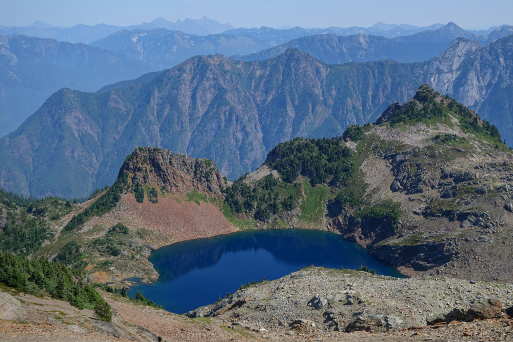
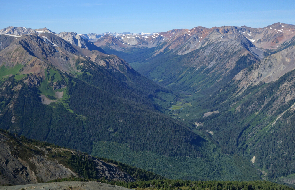
Baby Munday Trail - a bit overgrown on the initial stretch before the descent to Airplane Creek, although tame by local standards, avoid when wet or dew is present. Trail up to alpine below Baby Munday is a piece of work. Rooty, rocky, slippery, and steep as f#*k! Didn't notice so much on the way up, but OH MY was the down tedious. Trail forks just above tree line with the uphill/left fork presumably heading towards Knight. I went right traversing meadows and such following a path with some flagging heading for the basin between BM & Stewart. Scenic alpine basin up there with what looks to be a glacial remnant tucked away beneath Stewart and The Still. Headed up to an obvious saddle looker's right of Stewart, then scrambled broken rock to the summit. Descended the way I came and then headed for BM's north summit, because it's a 15-minute detour and there's probably zero chance of me coming back up here anytime soon. Views are outstanding though! Passed on Knight as all the talus hopping to get there didn't look all that appealing, and I had reached my turnaround time. 2 outta 3 ain't too bad, but no Peakbagger's Choice award for me on this day! 4 hrs to Stewart from where I parked and about 9.5 total. Neat zone to explore, right in the middle of the Cheam Range, but I gotta say that unless the roads are repaired soon, I regret to say that we're approaching the twilight years of favorable access to the core peaks here.
Vantage Peak - West Ridge via Cerise Creek, August 2021
Inspired by recent online reports and of course the description in SSWBC, I organized a fun "family" jaunt up Vantage Peak. I was keen to behold a different perspective on the Joffre Range, not to mention getting up close and personal with the aftermath of the 2019 landslide that obliterated much of the Cerise Creek Valley. The sheer magnitude of the landslide is awe inspiring if not still somewhat terrifying. Having been up this way a couple times prior for both Matier and Joffre, I found the hike to Keith's Hut completely unrecognizable, in part because I used the old approach from the east back then, but also because so much of the old trail has simply been buried under tons of mud and rock.
We followed what is now considered the summer trail, ending with a somewhat brushy stretch of road, which thanks to the recent rain got us nicely drenched before arriving at the edge of the devastation zone. As others have noted, keep your eyes peeled for cairns and rocks with pink spray paint for the best path through this area. This "trail" now skirts the right edge of the slide path and turns up for a bit beneath Joffre's NE Face before crossing a creek to the opposite side. The orange diamonds on the trees pick back up and guide you on a good trail again to the lateral moraine below Anniversary Glacier. Skipped the hut and followed a marked trail branching off to the left to reach the small valley below Vantage Col. Then up to the col where much gawking at the excellent views was had. A trail continues from the col up Vantage's West Ridge.
As noted in SSWBC, krummholz on the lower portion of the ridge is a bit of a nuisance and isn't particularly dog friendly either. At a prominent knoll/headwall, the trail turns right and promptly disappears in some talus. Kept going right until reaching grass slopes on the peak's SW Face before turning back up and regaining the ridge. Steeper scrambling and a couple moves along a sharp crest leads to the summit area. Noted more than a good dusting of fresh snow on the higher peaks further east along the Duffey. Back down after a few minutes of snapping photos, rejoining the nappers for a short break before the long grind back down. About 5 hrs up at a casual pace and about 9 hrs round trip. Did the Van Life thing near Duffey Lake that night and enjoyed a lazy, no-agenda morning the day after. Although it can certainly be done as a quick out'n back day trip from Vancouver, we took our time on this one and made a chill weekend of it, finally blowing the spiders out the Westy's tailpipe after far too many months of disuse!
Mount MacFarlane - Mt. MacFarlane Trail, August 2021
A quick rip up MacFarlane on a warm and mildly smoky August day. All pavement to trailhead parking and trail to alpine in great shape and easy to follow, albeit unrelentingly steep until reaching the meadow area below upper Pierce Lake. A new bridge crosses the creek now (as of June '21). There's a short scrambly bit up the headwall just below upper lake and again at about midpoint on the East Ridge, otherwise just a casual hike. Good views of Cheam Range, Border Peaks, Shuksan and her infamous Jagged Ridge, Rexford Group and of course Slesse from summit! Damn you Slesse! Yeah, yeah one of these days...bite me! About 4.5 hrs up and ~8.5 RT with :30 spent up top. Bumped into fellow peakbagger James Patterson whilst descending the ridge and enjoyed his company for most of the hike back down. Conversation sure helps the KMs go by faster! Like the other Mc's/Mac's in the valley, this makes for a great late Summer or Fall objective with stellar views of the North Cascades. Highly recommended!
Sunshine & Cadwallader (aka Crazy) - via Noel Creek FSR, August 2021
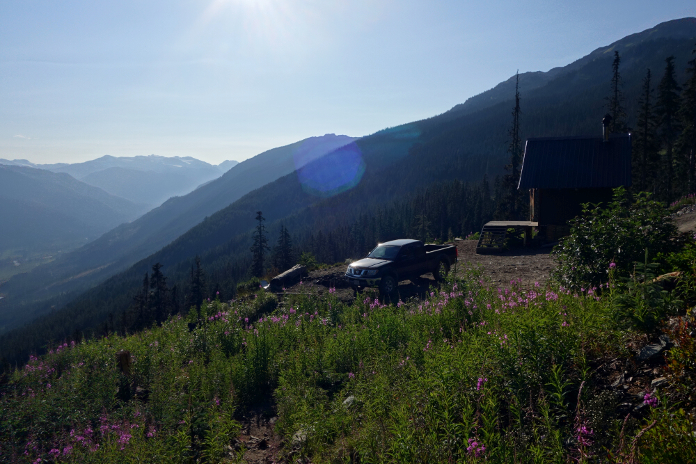
Two tries at this one having previously called it at Sunshine summit after balking at the loss and gain (and return) necessary to bag Crazy from there. Predictably, I couldn't just let that be the end of it and soon found myself back on the slopes of Sunshine staring down that dreaded descent. The drive up and down the Hurley is, well, the same monotonous, dusty, and bouncy affair it always is this time of year. Except, the grader was back for my round two and as of this writing has "smoothed" the road from the Bralorne Connector up and over Railroad Pass. Good enough to sucker me into relaxing my brake foot a bit too much resulting in a punctured tire. Time for a proper set of tires! Anyway, dealt with that and rolled into Bralorne proper, looking for the start of Noel Creek FSR. Thanks to directions from @danemoreau, I made my up the landing with ski chalet without further difficulty. Just take the left fork after a couple kms and you can't miss it. Water bars not too bad; doable in a regular SUV.
Trail up to the alpine follows an ATV/moto track that starts behind the chalet. Since I'd been up Sunshine before, I skirted the first false summit to a notch, then followed Sunshine's NW Ridge before again traversing talus slopes on the right (west) side, aiming for a prominent shoulder of gray-colored scree and gravel. Angled down this to reach the basin south of Sunshine then made my way back up onto Crazy's long NW Ridge. Easy from there before reaching craggier terrain below the summit block, traversing once more at right to bypass a bump along the way. As the terrain steepened towards the top, I traversed right into an obvious gully system and picked my way up loose rock to the summit. No real hands-on scrambling unless you go looking for it. Flying ants and the occasional mosquito interrupted the savoring of the fruits of my labor and I spent all of 10-15 min up there before heading back down. Turned into a scorcher of an afternoon and had heck of a time grinding back up that gray scree treadmill slope on Sunshine! No water en route, except for the occasion drip from snow patches. About 3:45 hrs to summit and 8:15 round-trip, down takes about as long as up thanks to talus and loose rock. Final Sunshine pics from a scenic detour along Carpenter Lake Road to Lillooet following my first attempt. Lots more to explore out this way and access seems generally good - Truax, Whitecap and the obvious ones in the South Chilcotins: Dickson (July '19), Harris Ridge, Shulaps etc. Yup, will be back.
Just had a half day to play and made my way over to Sootip being it's a short hike overall and generally pup friendly. Something like 8 km RT & 2500 ft gain, although it felt like more. It's a steep and rough drive up to the hut at the trailhead, not so much a matter of clearance, just lotsa loose, sharp rocks. Then again, an older Rav 4 with a lift made it up soon after my return but left behind a portion of the exhaust system on the side of the road. You've been warned.
Not long before reaching beautiful alpine meadows dotted with countless small lakes and tarns. Pepper made a point of bathing in every single one of them. It was a hot afternoon. Left the trail at some point to take a more direct line to the peak, crossing though several ups n' downs before again reconnecting with the trail, now marked on occasion with small red flags bearing the letters EMCO. Not sure what bathroom fixtures have to do with any of this, but anyway. Trail becomes indistinct higher up, but it's pretty obvious where to go. Fantastic 360-degree panorama from up top! Has an "island in the sky" feel to it, 2 hours car to summit. Started back down after about 30 min up top, following the EMCO flags this time, expecting to intersect the trail I was on earlier in the day. Things were going well until the trail petered out far to the left (north) of where I needed to be. Others appear to have suffered a similar fate here as there are random cairns and indistinct bits of a path visible in the heather on the cross-country trek back to the main trail. Saved by GPS! Trail confusion aside, this is hands down a high value objective and well worth the effort!
It would be very much appreciated if you please ask before copying and/or re-publishing content from any part of these pages. To do so, please click here to send a message via feedback form.


