


Cirque Peak - North Ridge, August 2009

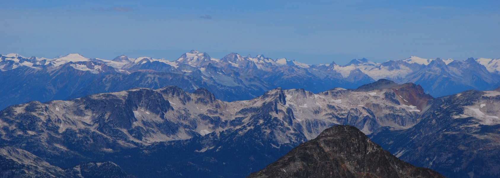
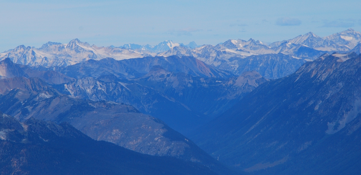
With soreness in the legs only just developing from the previous day's Ashlu climb, Eli and I got a lazy afternoon start from North Vancouver. We selected the North Ridge of Cirque Peak from Matt Gunn's Scrambles Guide as our next objective as it looked to us to be one of the more aesthetic, if not challenging (and loose) scrambles in the guide. The peak also lies in an area of mountains near Pemberton, BC neither of us had visited before. The idea of 'discovering' yet another perspective on the Coast Mountains was exciting to us. The fact that Cirque Peak seemed to offer a fun ridge climb with great position was an added bonus.
But first we had to get to the trailhead. After a longer than expected drive, we finally finished packing the gear and shouldered our packs around 3:30 pm. The standard parking area described in the guide is still in the same rough location, but seems to have been enlarged and paved since publication. Unsure if we were starting in the right place, the idea is to walk the dirt road immediately north of the paved parking area to a gate with railroad tracks just beyond. We crossed the tracks and continued past the gate on the opposite side. Carefully following the approach description per the guide from this point on, we located the trail and started the grunt up towards beautiful Place Falls.
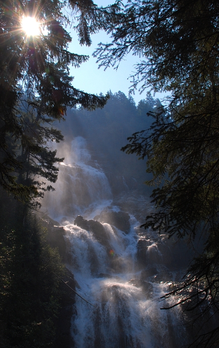
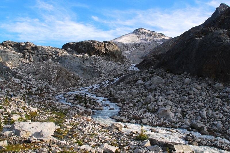
The falls can actually be seen from the parking area, but its actual size is difficult to gauge from so far below. Needless to say, Place Falls is most impressive and offers a welcome respite from the afternoon heat not to mention the brutally steep trail that comes next. After what seemed like an eternity, the slope angle eased-off with open forest giving way to a somewhat brushy trail shortly after crossing a smaller tributary of Place Creek. The brush then subsided giving way to patchy clearings with partial views of a prominent headwall up ahead. A final jog through a thicket of alders leads to a talus slope. Following the occasional cairn and strips of flagging, we proceeded up to the base of the headwall then made a rightward traverse beneath it towards the raging waters of Place Creek.
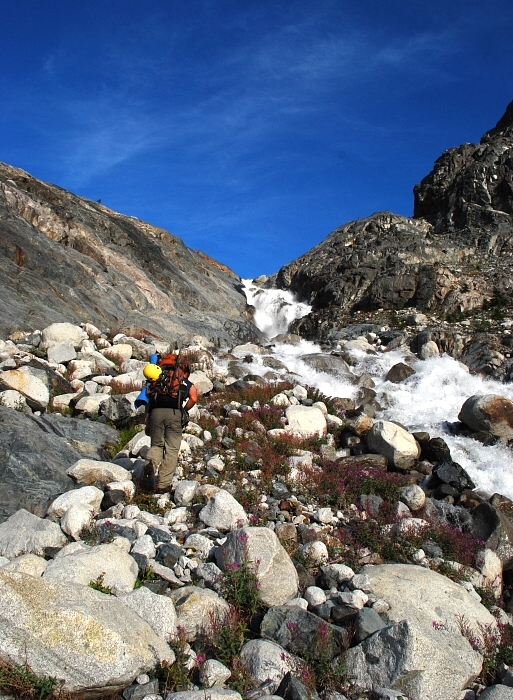
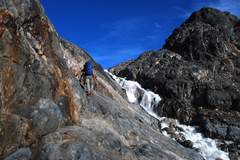
Paralleling the creek for a short distance, we located a weakness in the rock to our left and scrambled up 3rd-4th class slabs to gain the basin above the headwall. It wasn't apparent to us at the time, but rather than going up this weakness the guide suggests paralleling the creek to about the point where one cannot easily continue. After a bit of careful smearing across lower-angled slabs directly above the creek, the objective is to locate a left-trending seam/ramp that allows for an easy exit (we returned this way). In either case, both options would be next to impossible if wet, particularly on descent. I do not recall seeing any trees or other anchor possibilities sufficiently close to the edge suitable for a rappel either. If all else fails, going up or down the south side of Place Creek seems like a reasonable alternative, but would require either a frigid creek ford or a keen eye for boulders that can be hopped across. Earlier in the season there may be enough snow to walk up or along the creek directly into the upper basin.
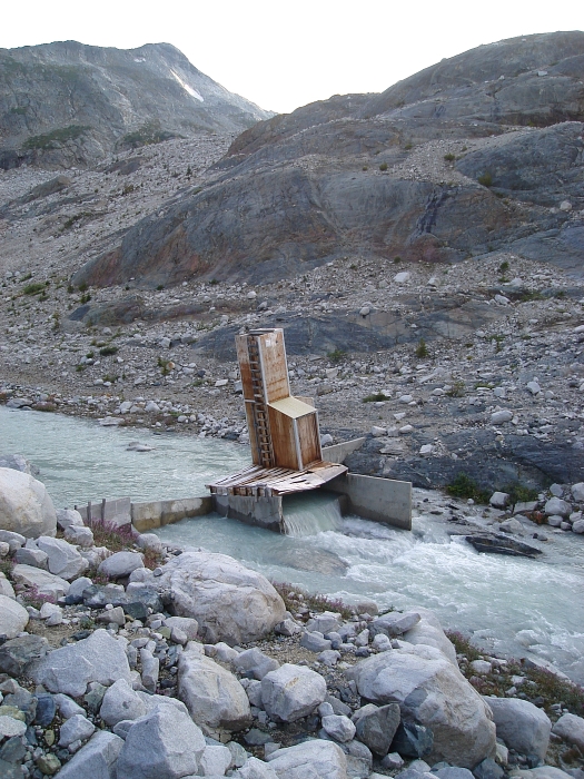
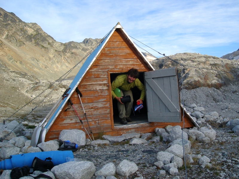
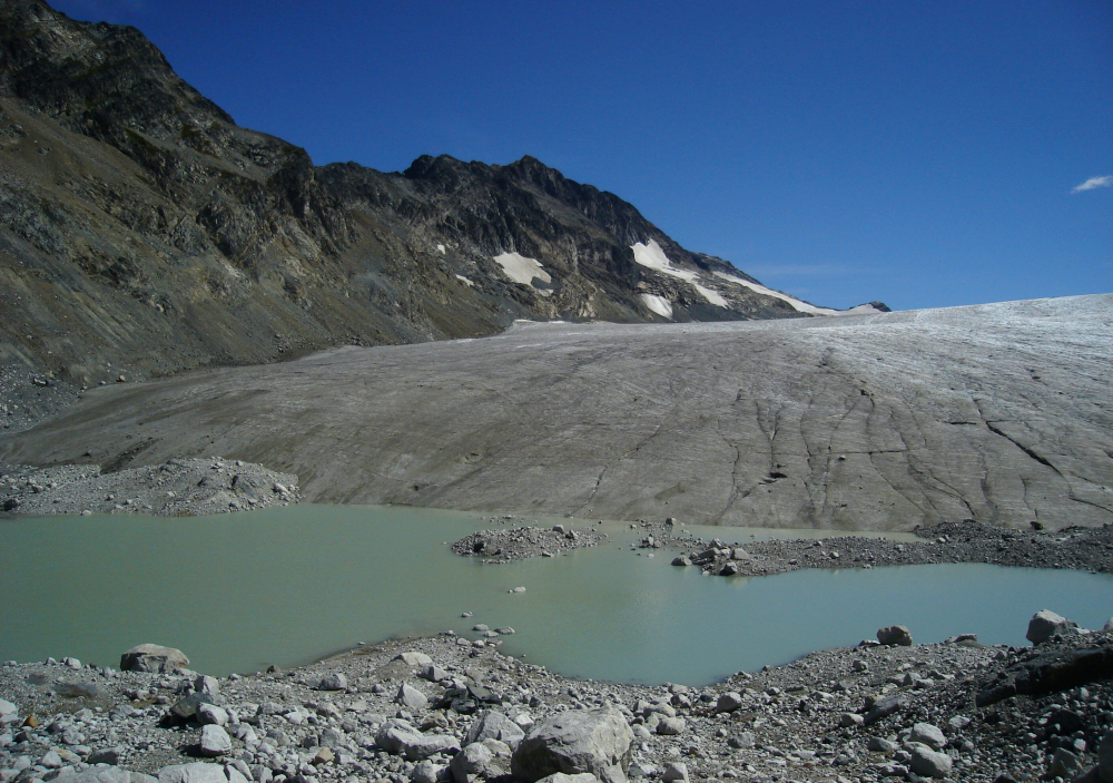
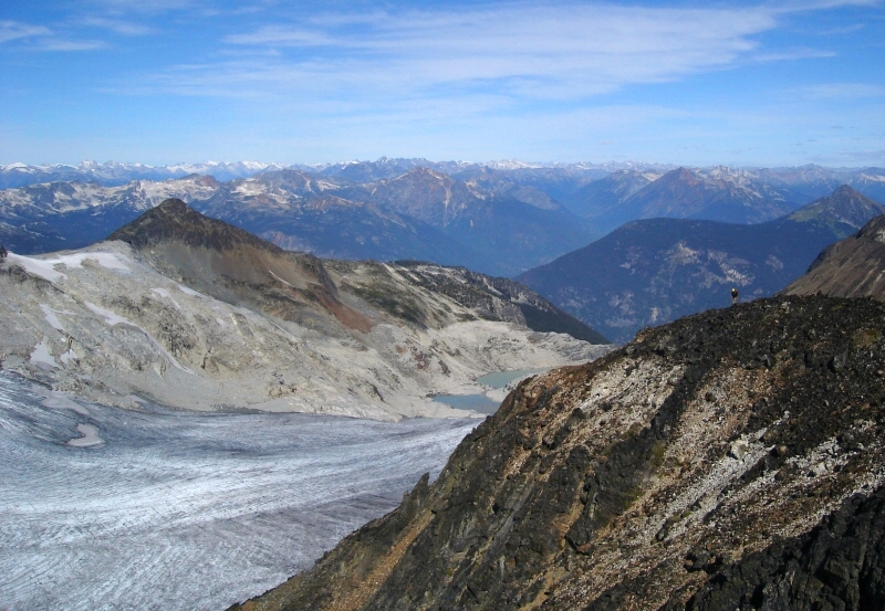
Following yet more cairns and bits of flagging tied to the tips of stunted evergreens, we walked along slabs into a rocky basin. Up ahead was a large rock dome with what appeared to be some antennae protruding from the top. Paralleling the left edge of the creek again, we passed a partially collapsed dam-like structure at the outlet of a large lake feeding the creek. We then contoured around the south-side of the dome in search of a place to camp. That's when I stumbled upon a small hut located near the top of the dome, with another larger one a short distance away (3 to 4 hours to here). In speaking with the party occupying the larger of the two huts, we learned that the facilities here have to do with the glaciology research taking place on the Place Glacier. In fact, similar to the South Cascade Glacier in the North Cascades, the Place Glacier is one of a handful of glaciers in North and South America where this research is being conducted. The larger hut has bunks for two, a table, propane cook top and small entry area and comes complete with outhouse and an array of weather vanes and wind speed monitors. Our hut, on the other hand was a smaller a-frame type structure that one couldn't fully stand up in. Inside it was stored shovels and various plastic buckets and whatnot we assumed are used by the researchers. Even with the gear in there, our hut could accommodate 3 if not 4 rather comfortably. Best of all, both huts are open to the public on a first-come-first-served basis with the simple expectation that one cleans-up after themselves and not tamper with the equipment or instrumentation.
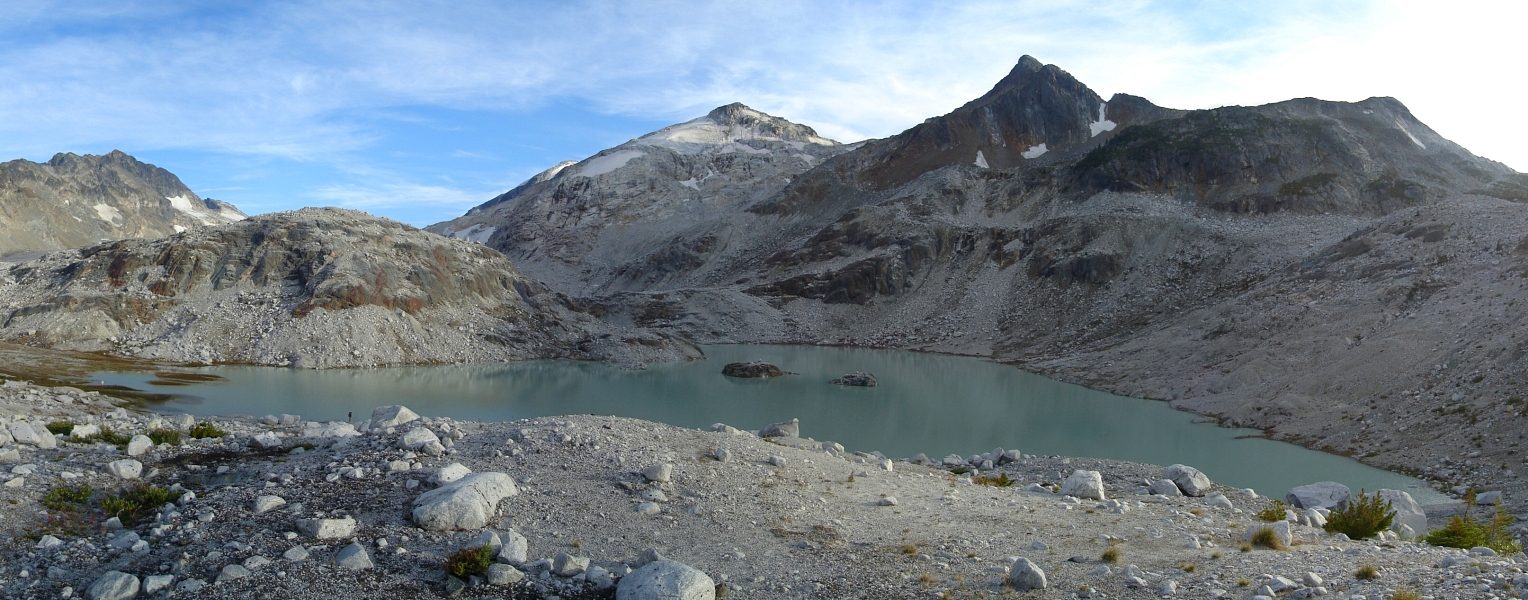
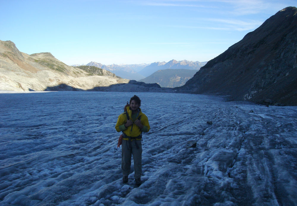
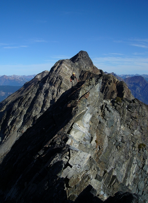
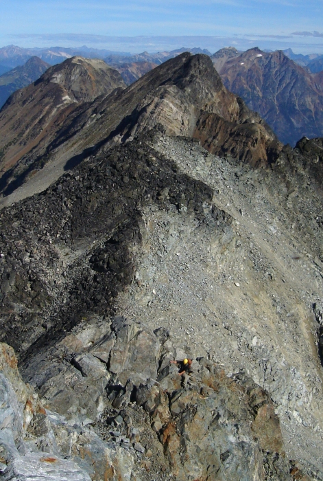
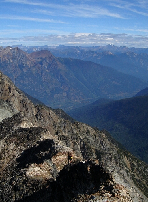
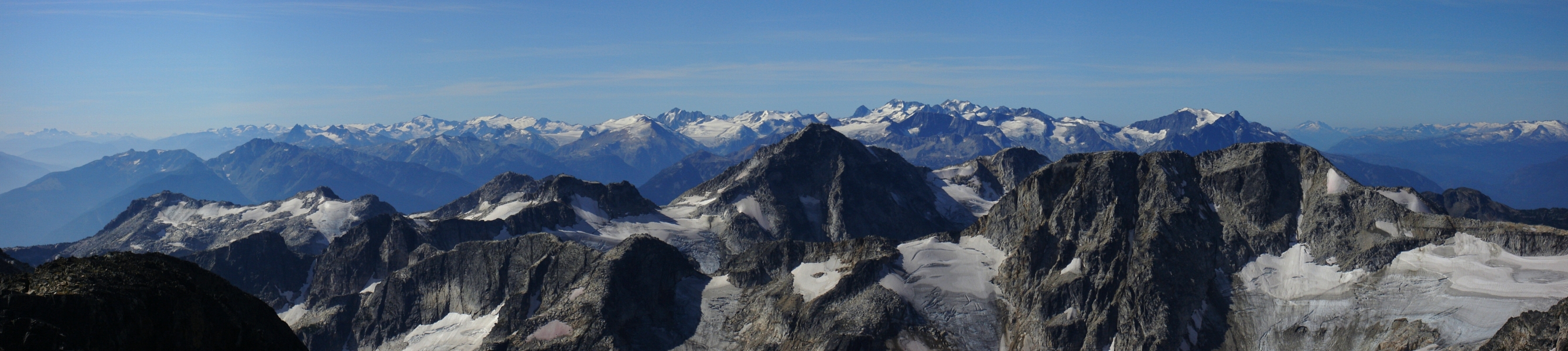
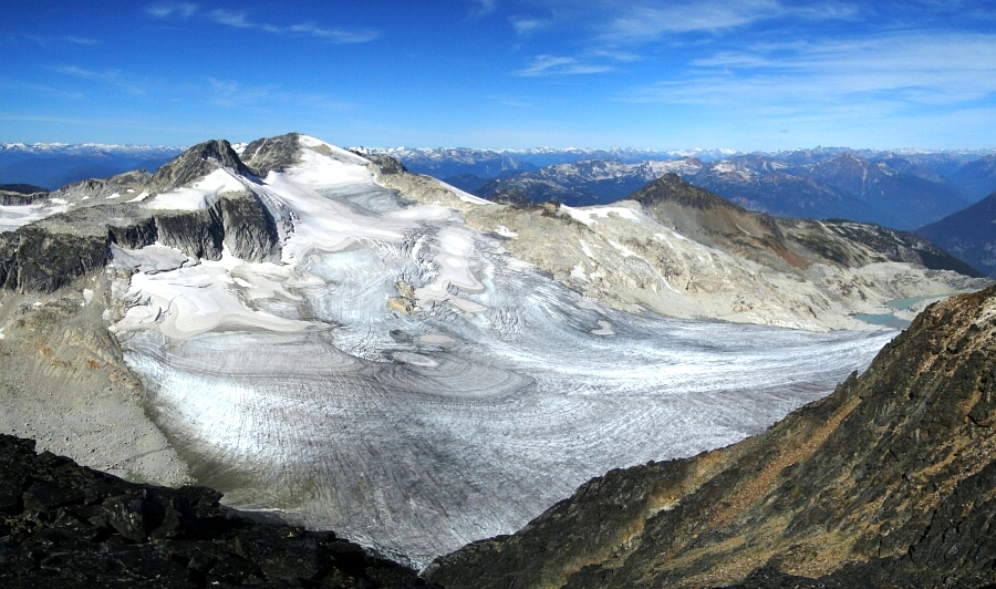
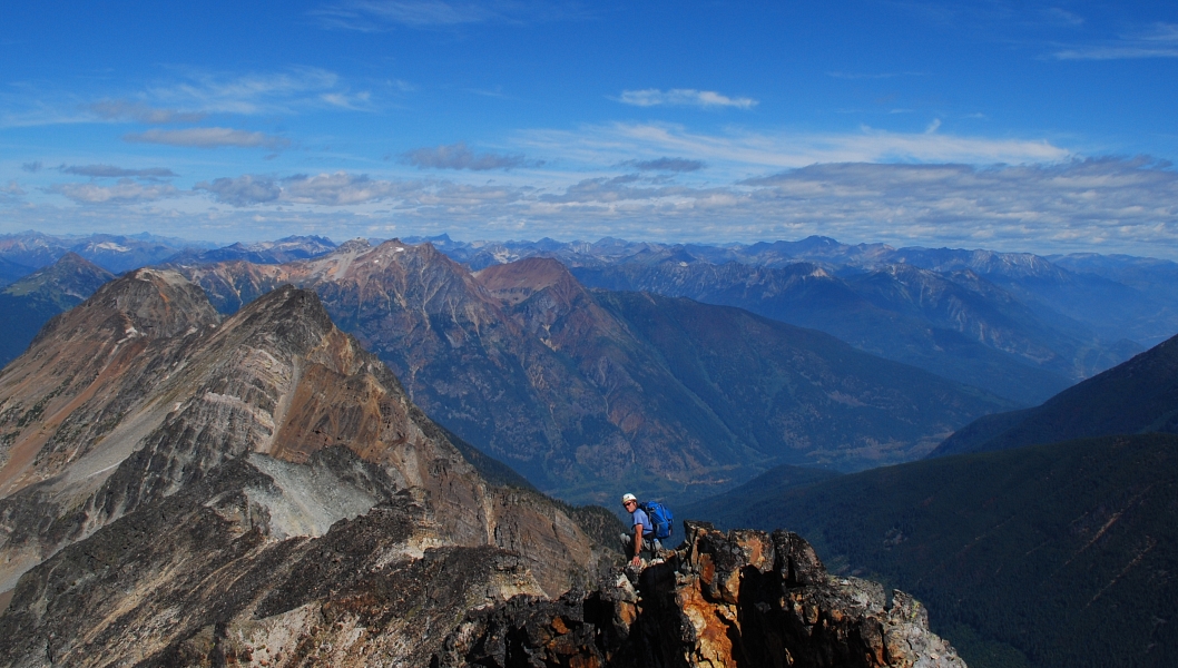
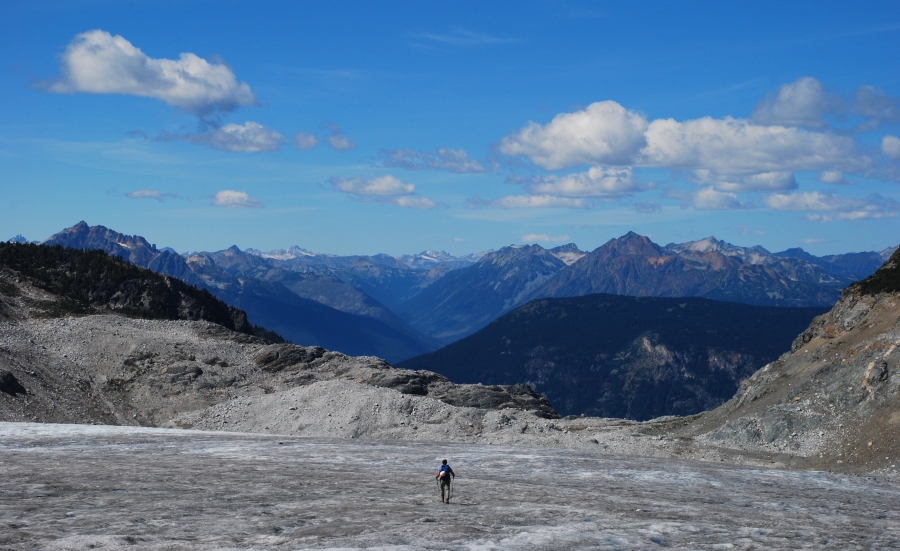
After a restful night thankfully out of the catabatic winds coming off of Place Glacier, we started towards Cirque's North Ridge at 6:00am. Trudging through the lunar-like landscape south of the huts (seen here), we gained the glacier by skirting the left-edge of a terminus lake. The glacier is almost flat over its entire surface area and was for the most part down to bare ice. The ice was however dirty and textured enough so as not to warrant crampons or an ice axe. Any crevasses we encountered were easily avoided or stepped over and were usually full of melt water. Aiming for a large talus apron breaking the crumbling cliffs at left, we endured a long, boring glacier walk before exiting onto the loose nightmare of a slope we would ascend to reach a saddle low on the North Ridge. After much sweating and cussing, we finally reached the saddle only to be greeted by swarms of hungry mosquitoes. From here the route seems harmless and the rock reasonably solid, and reveals nothing of the loose sketch-fest we would encounter towards the end of the ridge. From the saddle, easy scrambling along the crest led us to a sharp slanting arete before a notch. Climbing back out of the notch, we followed a shallow corner on the right-edge of a large left-sloping slab (seen here) to the base of a prominent tower. A steep, rotten gully at left is passed by scrambling around to the right where a steep class-4 gully leads to the top of the aforementioned tower.
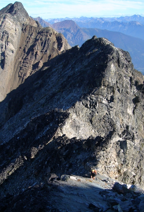
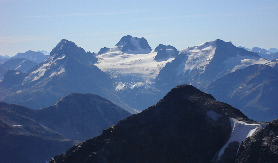
From there, a ramble over the next ridge hump brought us to a smaller but chossy saddle. Now, traversing along the left-side of the crest, we turned up and zigzagged through steeper broken rock and ledges back towards the crest. A final sandy ledge about 10 feet below the left-side of the crest soon peters-out and is avoided by climbing a short step up over and onto the right-side of the crest. A long, slightly descending traverse over talus then led us to another saddle before an exposed and rotten fin of shit-rock. Traversing below the fin on either its right or left side didn't seem survivable and it became readily apparent that the objective was to climb directly over the top. Crawling over the narrow and crumbling ridge, I reached the base of the fin and carefully pulled myself up onto teetering blocks for a short but stimulating scoot across to a saddle on the opposite side. Continuing with the loose theme, we followed the inexplicably chossy ridge over a series of somewhat exposed and utterly rotten steps before reaching the large, rounded summit area. Phew! Holy hell, I swear I'll never bitch about the rock in the Olympics again - Cirque Peak takes the cake folks! Forget the rope and protection - none of it would be of any use here!
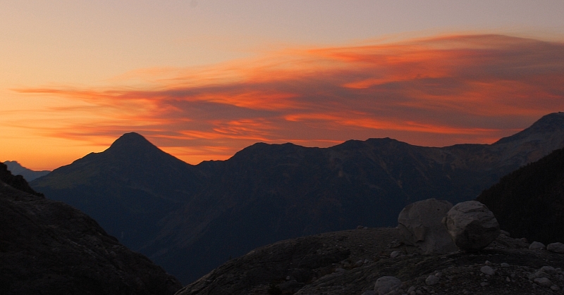
After a calming 45 minutes on top, Eli and I reluctantly started making our way back down the ridge. Delicately inching ourselves down the decaying fin, we then carefully crawled back to the saddle and breathed a collective sigh of relief. The rest of the descent back to the hut went without incident and we wasted little time getting to the serious task of relaxing in the warm afternoon sun. We were in no mood to hike out that afternoon, and so decided to take it easy and stay another night in the hut. That evening, a front of ominous blood-red clouds blew in from the east and we worried that we might come to regret our decision not to hike out that day. We awoke to a strong smoky odor the next morning and visibility was greatly reduced thanks to the smoke filling the valley. Fortunately the high clouds from the night before were nowhere to be seen.
Although the fires burning near Lillooet this summer were still far from being put out and the smoke that day could probably be attributed to that fire, it struck us how lucky we were not to have any smoke while on Cirque. I suspect the wind direction may have changed or something, but wow, what a difference from one day to the next! The party occupying the other hut even mentioned how smoky it was earlier the same day we hiked in. In any case, we didn't want to take our good fortune for granted and so added our names to hut's guestbook before descending into the *cough cough* valley.
Click here to view photos.
![]()


