


Mount Tantalus - North Ridge, July 2009
 as seen from the summit of Alpha Mountain.")
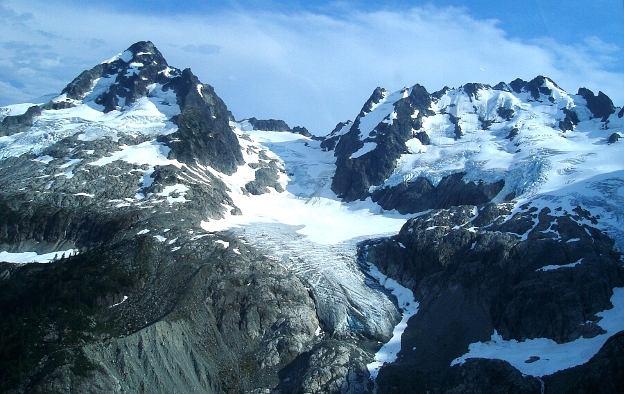
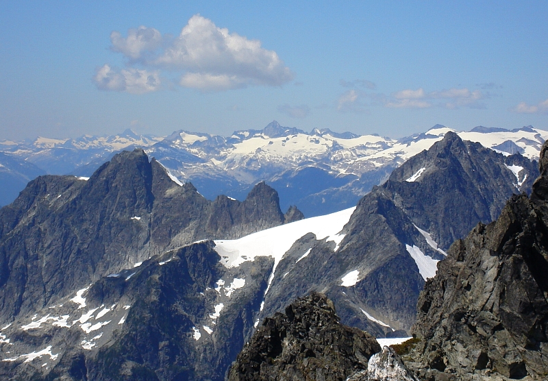
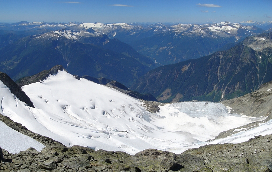
For our third and (probably) final Tantalus Range installment, Eric and I set out to climb the North Ridge of Tantalus Mountain. As before, we prearranged a heli-bump up to our home for the next two nights, this time at a location below the North Ridge proper. As expected, the views from the flight in were spectacular, bringing back fond memories of last summer's climbs of Alpha and Serratus. The short flight took us directly above the impressive Rumbling Glacier. This incredible glacier is so heavily fractured, it almost doesn't seem real. We expected to be dropped off at a luxuriously comfortable camp spot somewhere on a heathery ridge crest at the head of Mawby Creek. So it came as a bit of a surprise when the pilot informed us that he could only drop us off at one of two somewhat uninviting locations. Not exactly an exposed perch, but the col overlooking the northern most margin of the Rumbling Glacier was not exactly what we had in mind.
Fearing the ominous-looking thunderclouds rapidly advancing south along the Sea-to-Sky corridor, Eric and I immediately got to digging out a platform for the tent. As soon as we were done, we were treated to a frightening thunder and lighting show with showers not far behind. Fog then descended on our camp just as I was about to hide in the tent for shelter. Miraculously, the fog and showers lifted moments later revealing a large rainbow and the telltale streaks of heavy rain falling just east of us over Mount Garibaldi and the Squamish River Valley. It seemed the worst was over and the storm had fortunately only grazed us. In speaking with our pilot a couple days later, the downpours in Squamish were among the most intense he's ever seen!
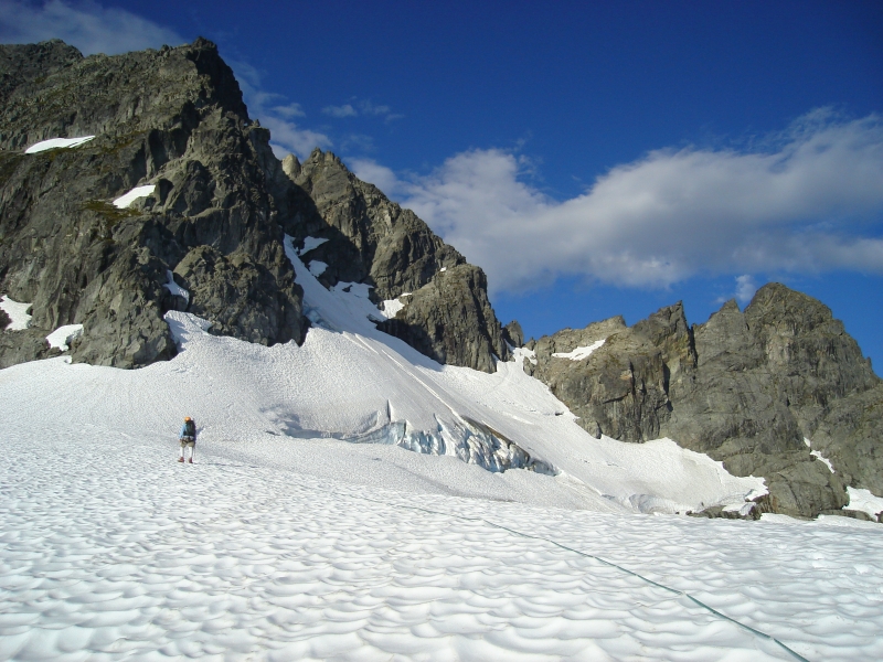
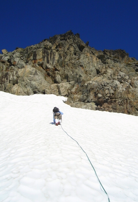
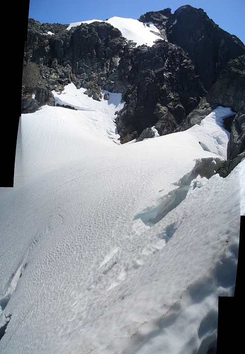
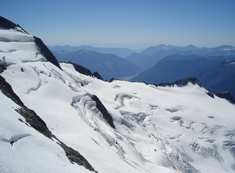
Much to our delight, the next day dawned with nary a cloud in the sky save for a few lazy streaks left over from the previous night. It was about 6:00am when we roped-up and started up towards the small glacier on Tantalus' north-side. A large bergschrund ran across the length of the glacier and would pose our first challenge of the day. Attempts to find a route through from below proved fruitless so we had no choice but to traverse above it. Eric kicked good steps in the (thankfully) soft snow until reaching an unusual crevasse running vertically down into the 'schrund. We could have climbed a pitch of snice along this feature to get around it; which really didn't appeal to us as going up steep, firm snow (not to mention going back down) directly above the yawning bergschrund without at least an ice screw or two or three, would have been sketchy at best.
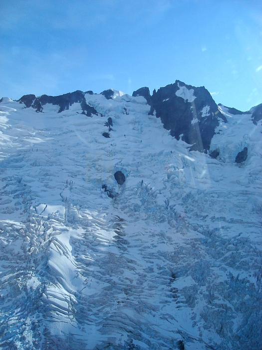
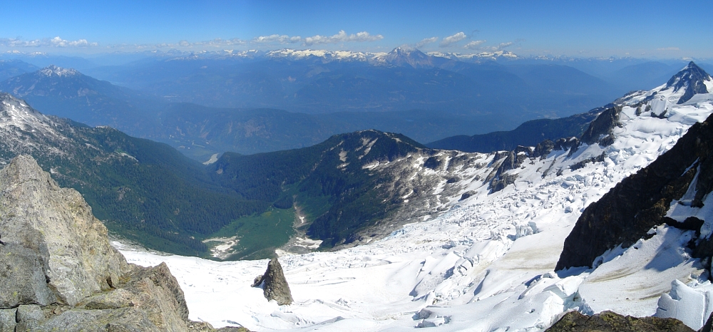
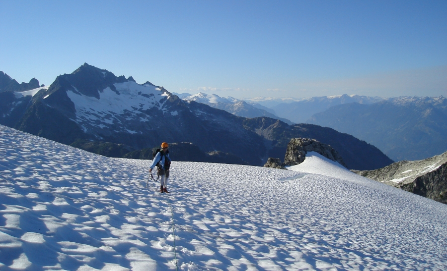
Indicating an alternate route to gain the ridge crest, the guidebook has a line drawn over the rock buttress overlooking the col. Seeing it in-person however, we struggled to make out a reasonable way up it. It seemed steep and committing, almost a climb in itself. There had to be a better way! Noting a large snow finger he'd seen from camp, Eric led out onto the Rumbling Glacier to investigate. Following a large and relatively flat glacial bench, we rounded a corner and scrambled some loose rock to reach a steep snow slope. A small snow arete above this slope lead to a short traverse onto a flat rock outcrop. We could see a steep snow finger continue upwards at left to just below an obvious notch in the ridge. Above us, a short pitch of snow (seen in photo) led to broken rock and what we hoped was easy climbing. We went this way. After hopping the moat, class-3 scrambling, and exposed heather pulling, we were led to easier terrain shortly before the aforementioned notch. I kept a keen eye for suitable rappel anchors, particulary on the steep heathery bit, but really couldn't find any. I quietly wondered if we could find an alternate way down, perhaps by rapelling into the apex of the snow finger. We would find out soon enough.
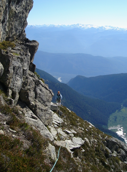
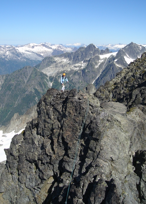
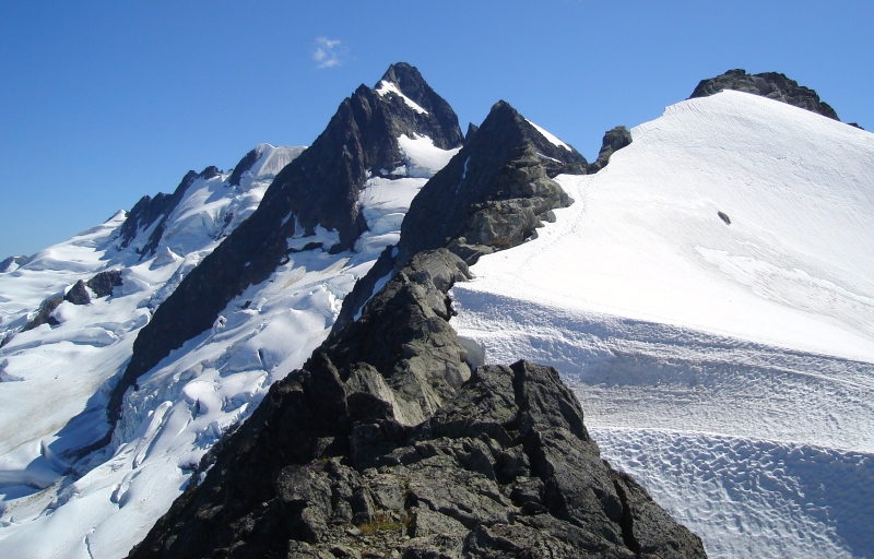
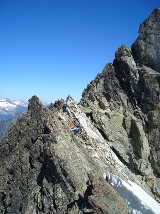
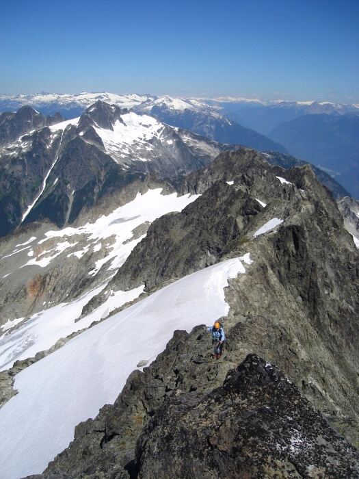
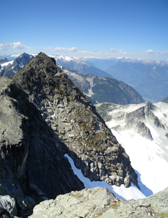
As best I can tell, we gained the notch directly after the first major highpoint in the North Ridge. Looking down the opposite side, we could see tracks on the West Glacier far below. Had we been able to complete the traverse above the troublesome bergschrund we'd have followed these tracks and gained the ridge somewhere higher up. Scrambling up from the notch the ridge becomes flat and smooth, and being about 10-feet wide really gives the impression of a literal sidewalk in the sky. Actually, there are numerous sections that appear this way. Very cool! I found the scrambling to be rather casual: anywhere from class 2 through class 4 and relatively low angled for the most part. At no point did I find it particularly airy or exposed. There were numerous ups and downs and several spots where we had to pass a more difficult section of ridge in a moat. Likewise, there were also deep notches or similar impasses where we had to hop off (or down-climb) the ridge over surprisingly deep moats onto snow only to regain the ridge a few steps later. Oh, did I mention the annoying moats? It slowly dawned on me how much more melted-out the conditions were compared to the same time of the year last summer. The low winter snowpack and prolonged summer heat have no doubt contributed to this.
The ridge eases back just before a small glacier saddle below the summit. A deep, dark chasm lies between the North Ridge's end and the summit block forcing a steep leftward traverse out onto the aforementioned saddle for the final pitches to the top. Giant moats complicated the exit from the ridge with only one small, sagging snow bridge with deep slots showing on all sides for added effect. This seemingly offered the only exit. There was some evidence of footprints over this bridge, but they certainly weren't recent. I couldn't muster up the courage to set foot on it. Just a little too dicey for me. We could rappel, but how would we return? I briefly probed around for options, but that amounted to little more than a solo effort. The pressure coming from the other end of the rope to bag the climb did little to bolster my own shaky confidence. Yes I know all too well that appearances can be deceiving, but that lesson was somehow forgotten on this day. I am certain that with a little more persistence and fortitude on both our parts, an acceptable route could have been located. It's not like we can just run up this ridge any weekend!
The view down onto the Rumbling Glacier was jaw dropping and feautres a cool looking nunatak! Looking over the Rumbling towards the Sea-to-Sky highway I was reminded of the awe I feel every time I see the these peaks from the road going to-and-from Whistler or beyond. Honestly, this has to be one of the more impressive mountain vistas viewable from the side of a road in all of the Northwest. Right? So back down the ridge we go, making it back to the notch in good time. Rather than down-climb the steep, un-protectable, un-rappelable heather we elected to rappel off a horn down to the snow finger. An ice axe carelessly dropped in a moat added a little drama to the afternoon, but we eventually made it back down to the rock outcrop from earlier that morning. Retracing our steps from there we slogged back to camp without further complications.
Our ride came and picked us up around 7:30am the next morning. The Squamish air/heliport was abuzz with preparations for the day's round of fire-fighting efforts. Watching the giant Chinook take off and maneuver an 1100-gallon drum off the tarmac was enough of a distraction for me to momentarily forget our defeat. Only 8:00am and it was already uncomfortably warm. Never mind the heat, our ambitious plans to also climb the East Ridge of Mount Ashlu on this trip, had long since been nixed. Instead, I enjoyed a tasty omelet at the Squamish White Spot before the drive back to Seattle. Were it not my turn to drive, I'd probably had a sixer of Kokanee under my belt...well before reaching the border.
Click here to view photos.
![]()


